swipe gif icon

Use your mouse or touchscreen to explore the 360° panoramic views
An immersive and evocative visual experience that embraces the entire panorama.

sun lounger icon
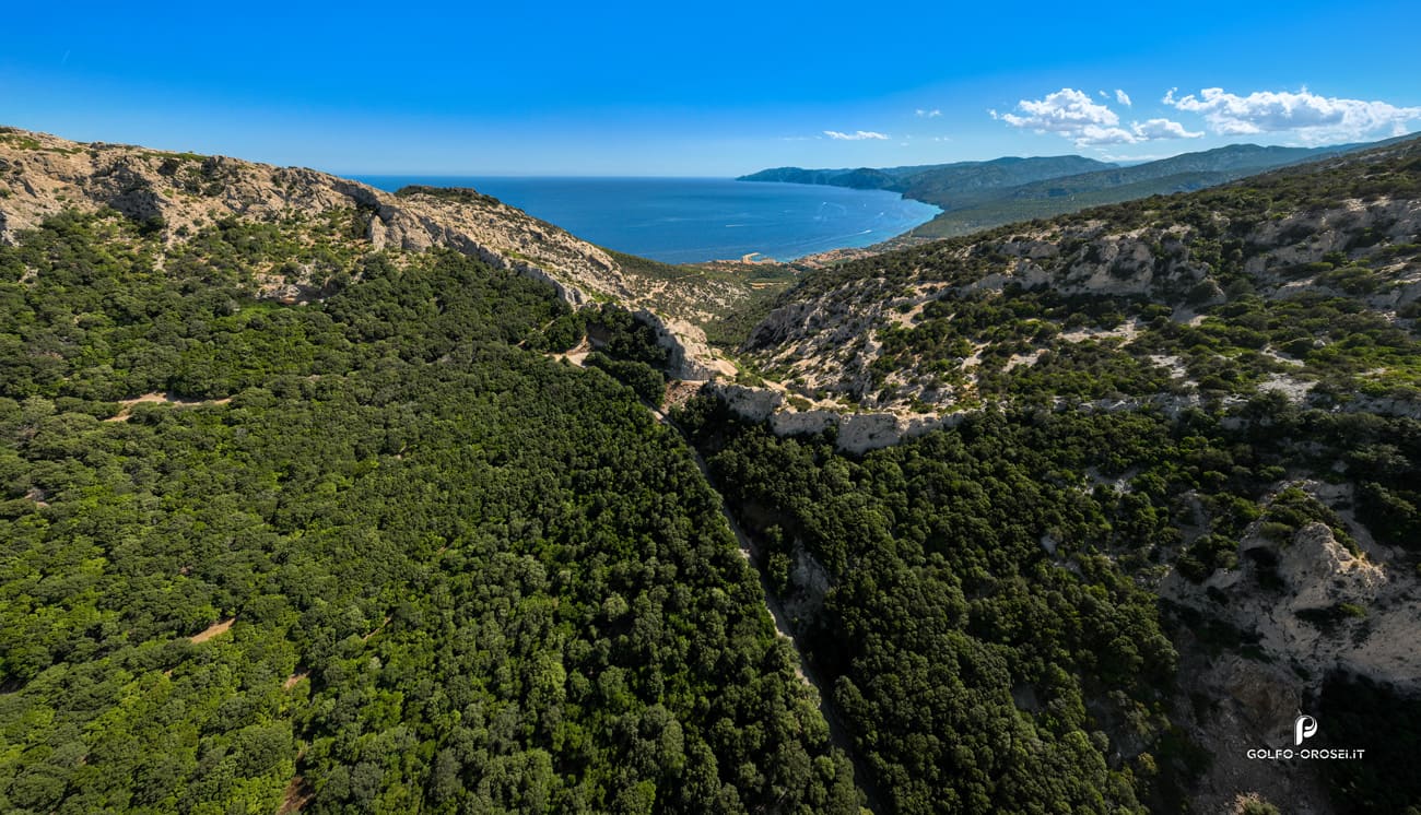
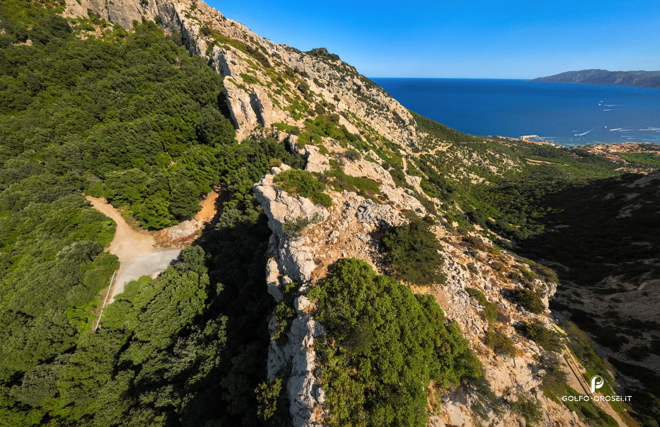
A wild, remote & unspoiled beach with untouched natural landscapes and a calm atmosphere.

website click iconThe page that is dedicated to relevant and useful information to the community.

location pin icon
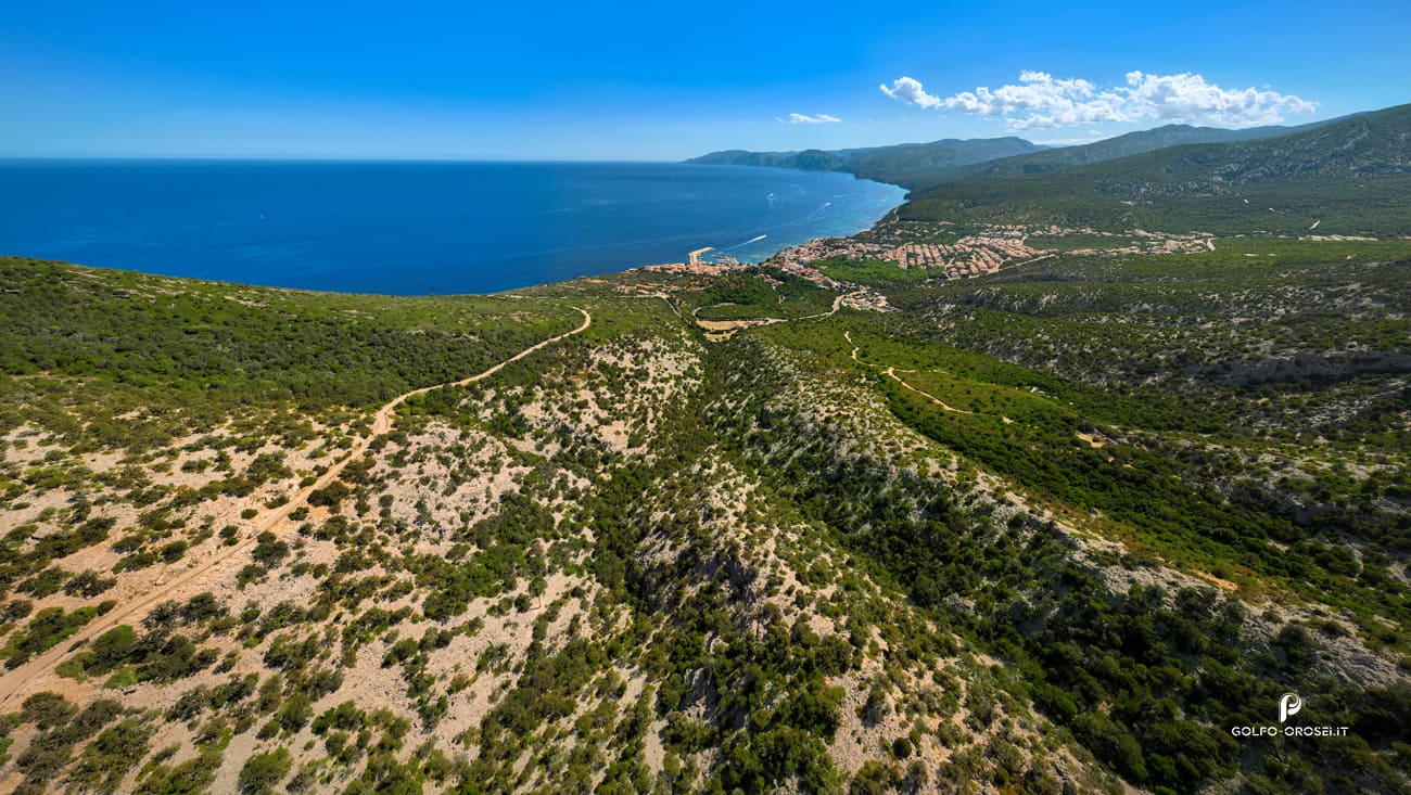
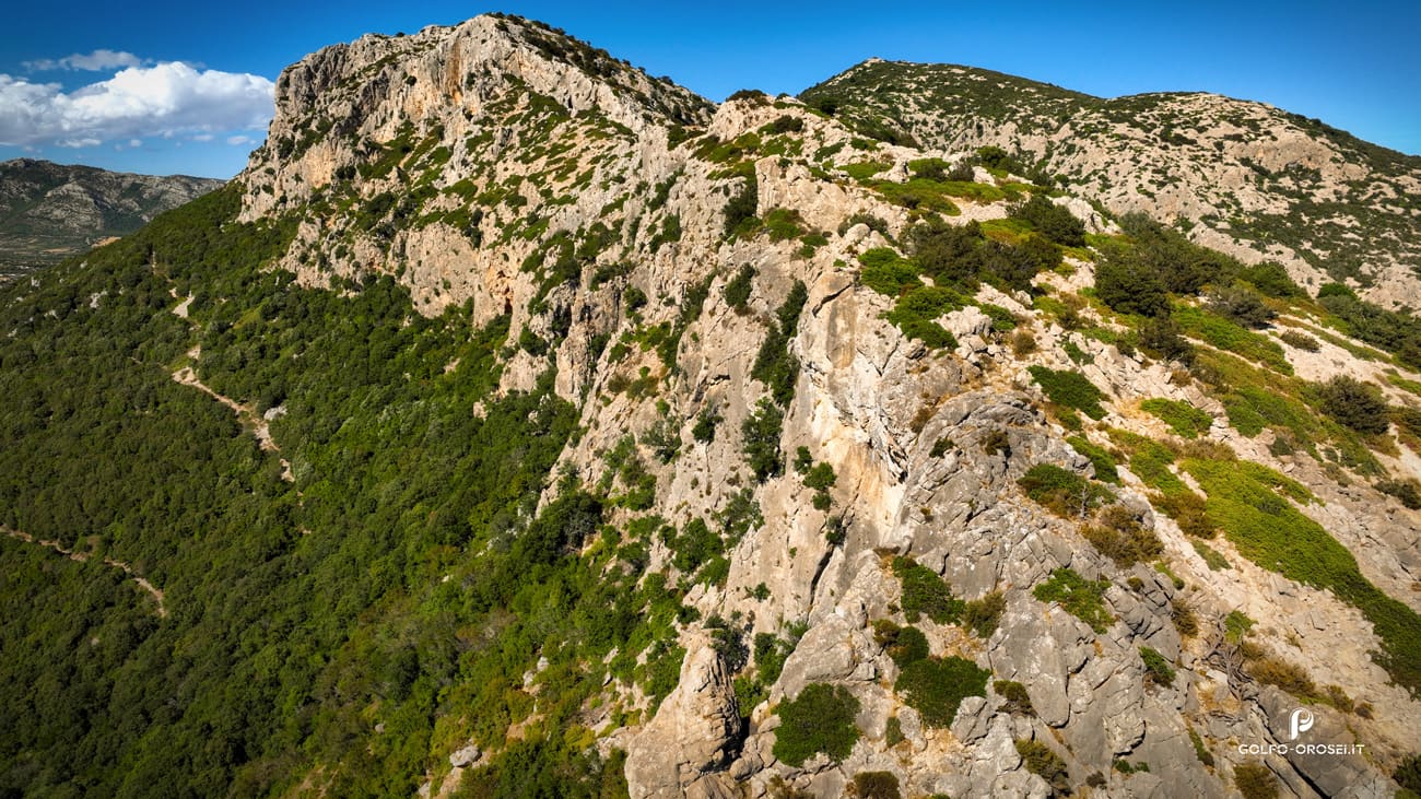
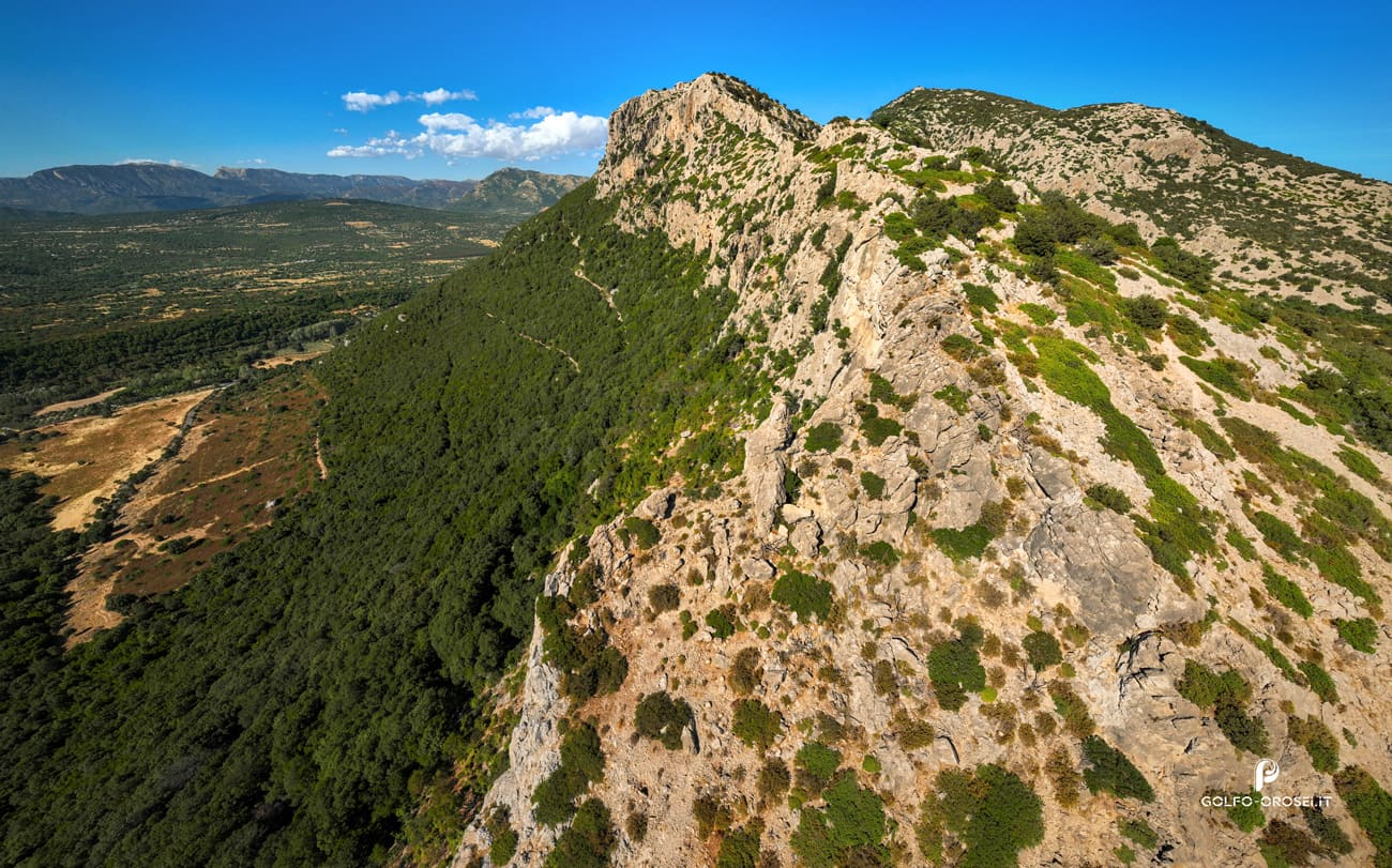
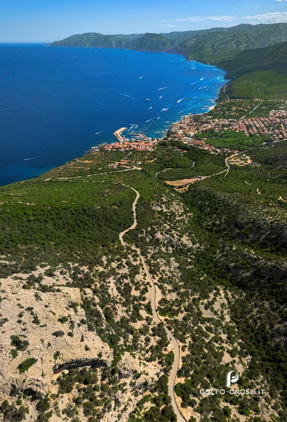
A 360-degree panoramic viewpoint offers a complete view of the surrounding environment.

icon meteo info iconFind out easily up-to-date weather information for the most visited cities.

map icon
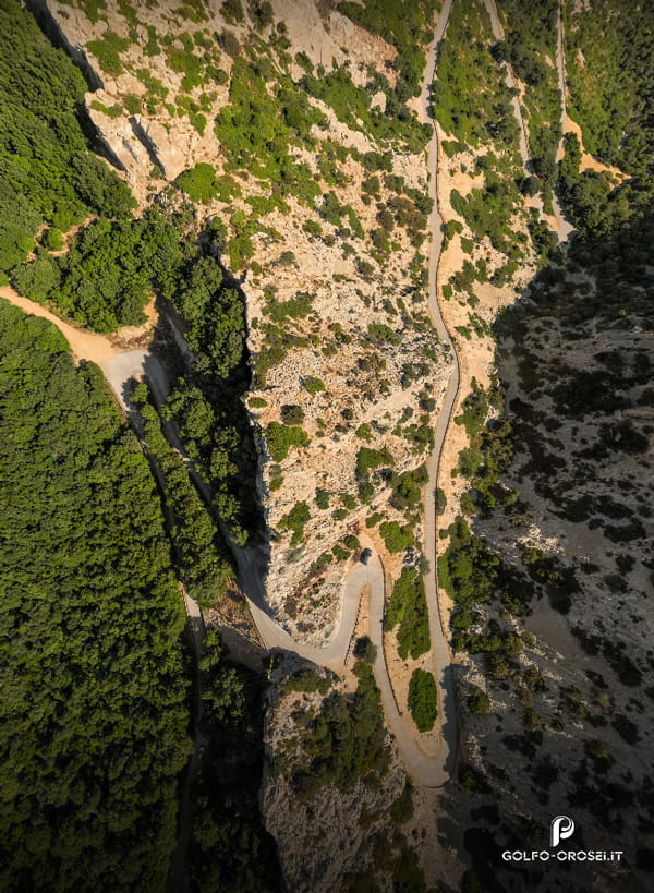
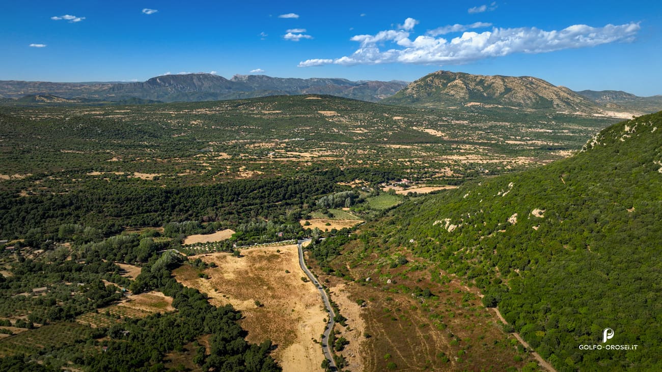
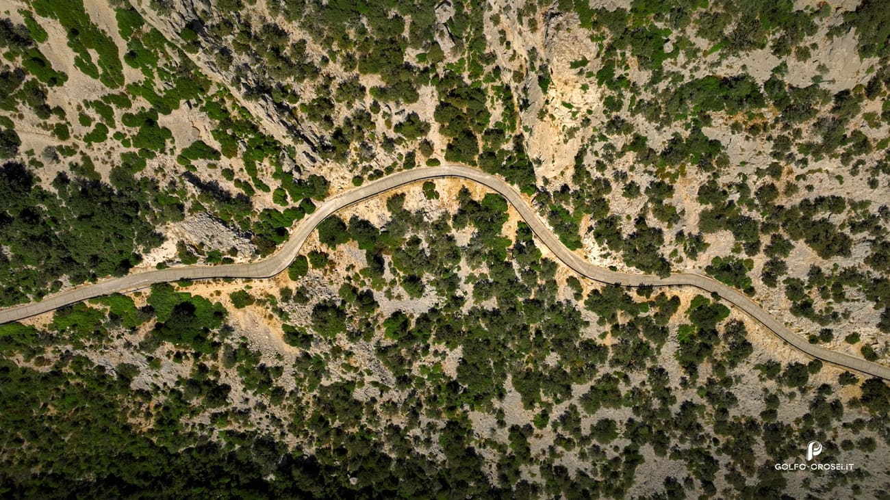
The map or a place for surrounding tourist areas or routes to nearby attractions.

alarms notification iconDining places of the area that offer a variety of culinary delights.

Meteo icon Stars icon IT
Interactive map menu Golfo Orosei
Filter svg icon

Select the desired parameter to customize your search.

close icon

Share with your Friends

Passo Littu

Passo Littu is a junction point located within the municipality of Dorgali, along the road that links Cala Gonone with the inland areas and the Supramonte plateau. This section marks the entrance to the karst environment and the network of trails that allow visitors to explore the wilder parts of the territory.

Check the Temperature iconweather forecast and choose the way that suits you best.

Passo Littu air view

Over time, the passage of Passo Littu has represented a transition zone between two very different environments: on one side the coast of Cala Gonone, historically connected to fishing activities and maritime routes; on the other the inland area of Dorgali, characterized by a strong pastoral tradition. Passo Littu has allowed local communities to move between grazing lands, agricultural areas and access points to the sea, maintaining a constant relationship between the mountains of the Supramonte and the coast of the Gulf of Orosei.

With the development of modern road infrastructure and the road connecting Cala Gonone to Dorgali, Passo Littu has maintained its function as a passage between coast and inland areas, becoming today more a of transition point within the landscape than a populated or structured place.

Its position continues to reflect its historical role as a connection between different environments of the territory, reminding us how in this part of Sardinia the relationship between sea and mountains has always been close and essential to the life of local communities.

Passo Littu Passo Littu view
Location: Passo Littu

Hiking Role in the Gulf of Orosei

Littu Pass represents one of the most practical access points for visitors staying in Cala Gonone who wish to add a trekking experience to their holiday. From here it is possible to join the route of the Cammino dei Beati, a trail that crosses the territory between sea and inland areas following ancient pastoral paths and locations connected to local traditions. It also connects to Stage SI Z12 of the Sentiero Italia CAI, which runs through the Supramonte of Dorgali among karst landscapes and Mediterranean scrub.

For those staying in Cala Gonone, Littu Pass therefore becomes a natural gateway to trekking: within just a few minutes it is possible to move from the coastal environment of the Gulf of Orosei to inland hiking trails, making it easy to combine a day of walking with the typical seaside activities of the area.

The road to the Littu Pass
Location: The road to the Littu Pass

Trekking: Cammino dei Beati

The Cammino dei Beati is a pilgrimage and trekking route that begins in Orosei and crosses the territory of the Supramonte of Dorgali, linking places of significant spiritual, historical and natural value. The route takes its name from the Blessed martyrs of Dorgali, figures deeply connected to local religious tradition and develops along paths, rural roads and ancient passages historically used by inland communities.

Along the route, very different environments alternate: from the coastal landscapes of the Gulf of Orosei to the inland areas of the Supramonte, characterized by limestone plateaus, Mediterranean scrub and karst scenery.

Supramonte Supramonte nature
Location: Supramonte

The Cammino dei Beati therefore combines the hiking experience with cultural and spiritual elements. Walkers cross territories linked to the pastoral and religious history of the region, encountering rural churches, traditional routes and scenic viewpoints that reflect the relationship between local communities and their land. The route is walked both as a pilgrimage and as a nature itinerary, offering the opportunity to explore the Supramonte and the Gulf of Orosei through a slow journey that brings together sea, mountains and tradition.

Sentiero Italia: Stage SI Z12

Stage SI Z12 (Supramonte of Dorgali) of the Sentiero Italia CAI crosses the territory of the Supramonte of Dorgali, one of the most distinctive environments of eastern Sardinia. This section of the Sentiero Italia develops across limestone plateaus, Mediterranean scrub and karst valleys, connecting the coastal area of the Gulf of Orosei with the mountainous inland landscape.

The route follows ancient pastoral paths and rural roads historically used for movements between grazing areas and the inland zones of the Supramonte.

Passo Littu trekking
Location: Passo Littu trekking

From a hiking perspective, Stage SI Z12 is characterized by a largely untouched natural environment and by terrain typical of karst landscapes: exposed limestone rock, dirt sections and trails crossing Mediterranean vegetation. The route requires a good level of walking experience and attention to orientation, especially in sections where the landscape becomes more open and the path less clearly visible.

Along this section it is possible to observe the strong contrast between the mountainous environment of the Supramonte and the nearby sea, one of the distinctive features of the territory of Dorgali and the Gulf of Orosei.

Supramonte di Dorgali
Location: Supramonte of Dorgali

The trails that develop between Cala Gonone and the Supramonte of Dorgali cross natural environments that are often wild, with rocky sections, uneven terrain and trail markings that are not always clearly visible. For this reason, it is recommended to tackle these routes with proper hiking shoes, sufficient water and a good knowledge of the route.

Before starting, it is useful to check weather conditions and, for those unfamiliar with the area, consider relying on a local guide or following established itineraries. Proper preparation allows hikers to enjoy the trekking experience safely while fully appreciating the landscapes between sea and mountains that characterize this part of the Gulf of Orosei.

The Best Aerial Views

Cala Mariolu Air View Point
Location: Cala Mariolu view.
Cala Goloritze Air View Point
Location: Cala Goloritze view.
Cala Gonone Air View Point
Location: Cala Gonone view.
Cala Luna air view point
Location: Cala Luna view
Grotta bue Marino air view point
Location: Grotta Bue Marino view
Nuraghe Mannu air view point
Location: Nuraghe Mannu view
Cala Biriola air view point
Location: Cala Biriola view
Cala Fuili air view point
Location: Cala Fuili view
Cala Liberotto air view point
Location: Cala Liberotto view
Cala Sisine air view point
Location: Cala Sisine view.
Cala Cartoe air view point
Location: Cala Cartoe view.
Passo Littu air view point
Location: Passo Littu view.
Su Petrosu air view point
Location: Su Petrosu view.
Villaggio Nuragico Tiscali air view point
Location: Villaggio Nuragico Tiscali view.
Sos Alinos air view point
Location: Sos Alinos view.
Orosei air view point
Location: Orosei view.

Helpful information

  • location icon Approximate coordinates: 40.279° N, 9.628° E
  • map icon Location: Passo Littu is located in the municipality of Dorgali, along the road connecting Cala Gonone with the inland areas and the Supramonte plateau.
  • car icon Access: Easily reachable by car from Cala Gonone (about 5–10 minutes) or from Dorgali (about 10 minutes) via paved road. Off-road vehicles are not required.
  • parking icon Parking: It is possible to stop in roadside lay-by areas near the pass. There are no official designated parking facilities.
  • distance icon Trail access: Passo Littu serves as an access point to the hiking network between Cala Gonone and the Supramonte of Dorgali, including connections to the Cammino dei Beati and Stage SI Z12 of the Sentiero Italia CAI.
  • information icon Environment type: Transition area between the coastal landscape of the Gulf of Orosei and the karst environment of the Supramonte, characterized by limestone formations and Mediterranean scrub.
  • Trekking icon Recommended trekking equipment:
    • Hiking shoes with good grip
    • Water (at least 1–1.5 liters per person)
    • Hat and sun protection
    • Clothing suitable for rocky terrain
    • Light backpack
  • calendar icon Recommended season: Spring and autumn are the best seasons for trekking. In summer it is advisable to start early in the morning to avoid high temperatures.
  • information icon 2 Safety advice: Trails may include rocky sections and signage that is not always clearly visible. It is recommended to check the route beforehand and, for those unfamiliar with the area, consider hiring a local guide.

For your Advertising

A simple and targeted opportunity to be found by those looking for experiences in the area.

Learn more
Faq Passo Littu

FAQ

Passo Littu is located in the municipality of Dorgali, along the road connecting Cala Gonone with the inland areas and the Supramonte plateau.

Passo Littu is a practical access point to the hiking network between Cala Gonone and the Supramonte of Dorgali. From here hikers can reach routes such as the Cammino dei Beati and Stage SI Z12 of the Sentiero Italia CAI.

Passo Littu can be reached easily by car from Cala Gonone in about 5–10 minutes or from Dorgali in about 10 minutes via paved road.

There are no official parking facilities, but it is possible to stop in roadside lay-by areas near the pass.

From Passo Littu it is possible to access trails connecting the coast to the Supramonte, including the Cammino dei Beati and the Sentiero Italia CAI – Stage SI Z12.

Passo Littu itself is easy to reach, but the surrounding trails may include rocky sections, uneven terrain and limited trail signage. Basic hiking experience and preparation are recommended.

Recommended equipment includes hiking shoes with good grip, water, sun protection, comfortable clothing suitable for rocky terrain and a light backpack.

The best seasons are spring and autumn. In summer it is advisable to start early in the morning to avoid high temperatures.

Leave your Review