

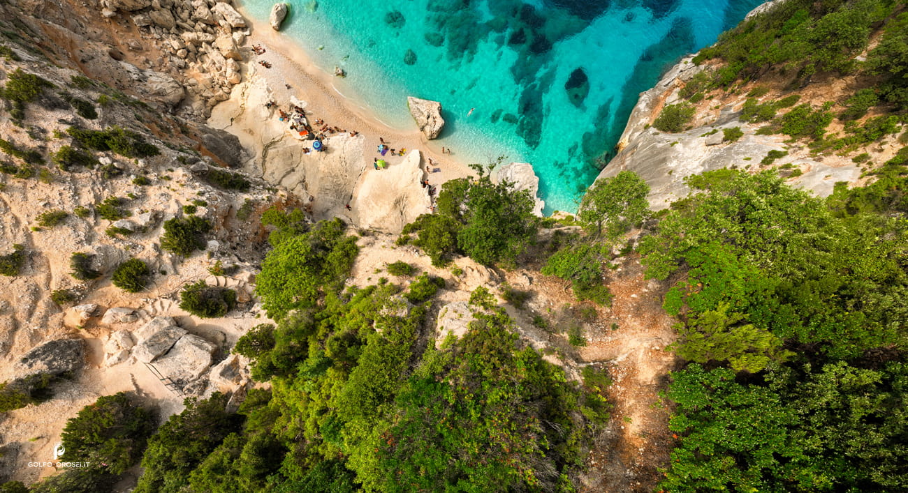
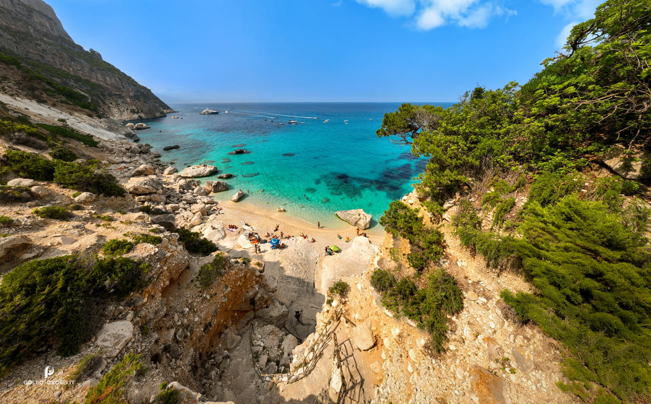
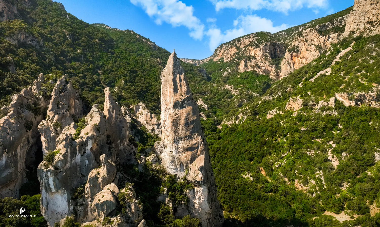
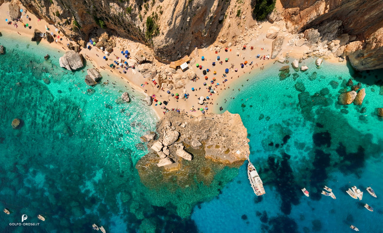
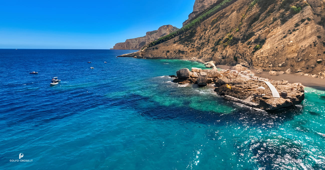
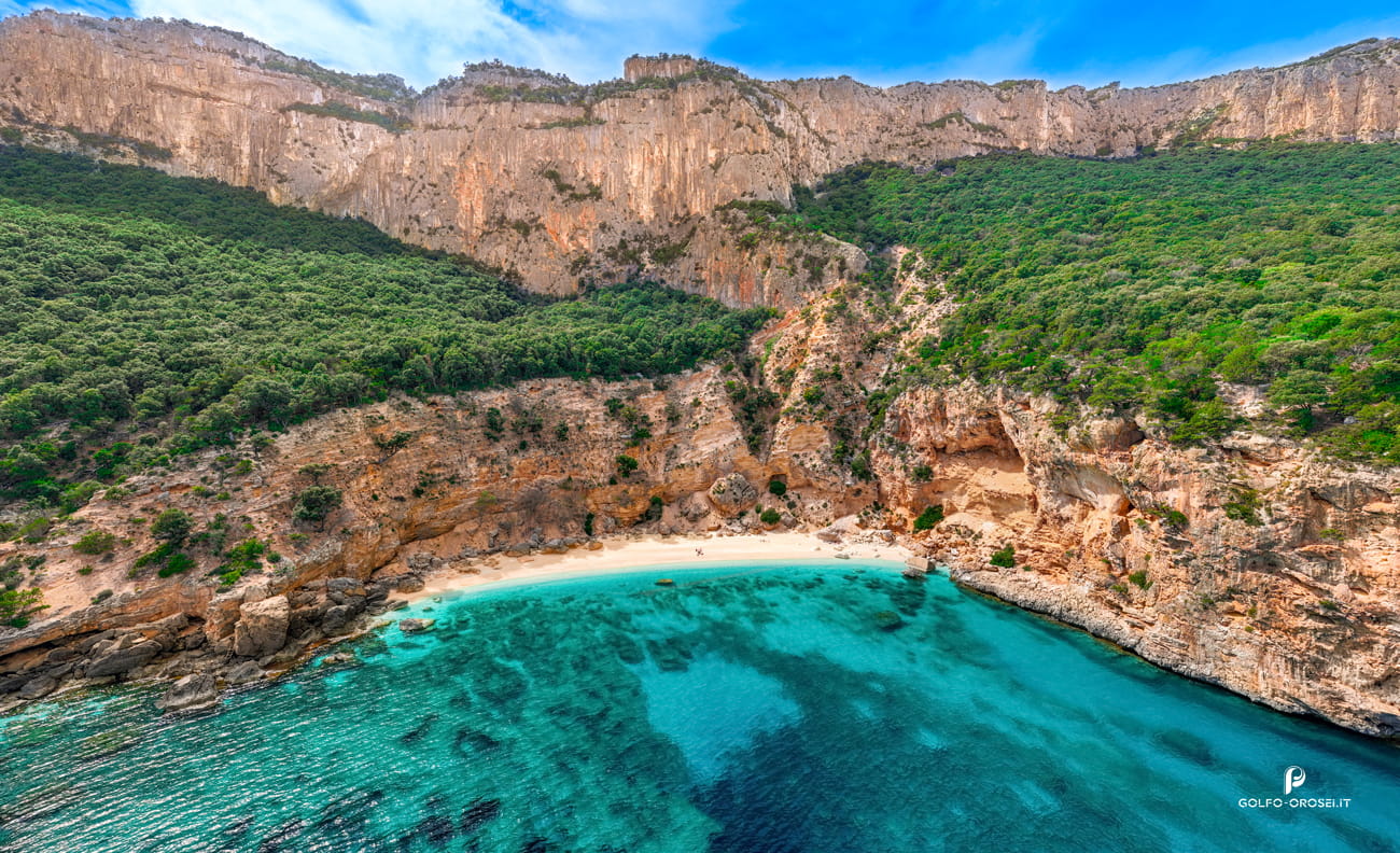
At the end of a long limestone trail, Cala Goloritzé appears almost abruptly, as if the mountain had opened a door to the sea. This Sardinian beach itself is small, but the real spectacle rises behind it: a 143-meter limestone pinnacle known as , a natural monument that climbers treat like a cathedral wall.
Boats must stop offshore, which changes the rhythm of arrival. You swim the final meters, watching the color of the stones shift under the water from pale ivory to deep grey. The story of this cove actually begins with a landslide in 1962. That accident created the beach visitors photograph today. Why it became Sardinia’s most protected shoreline is another story worth discovering on the full page.
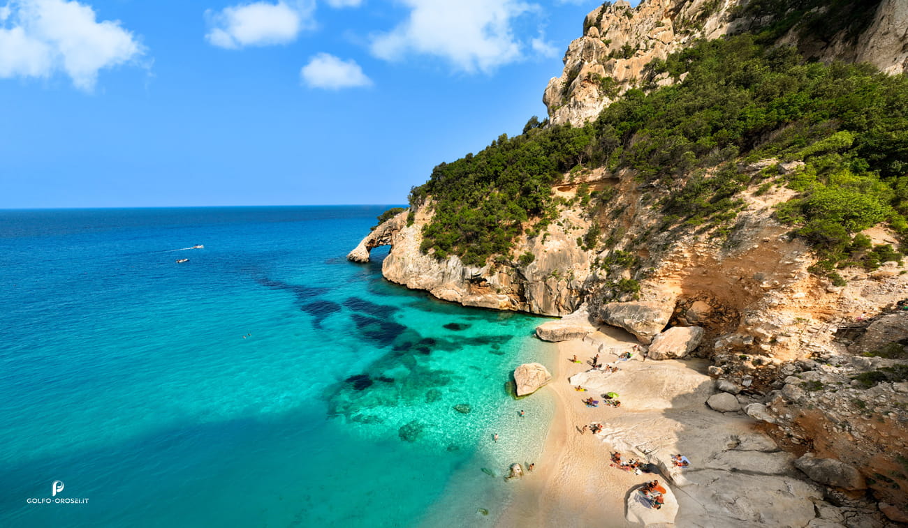
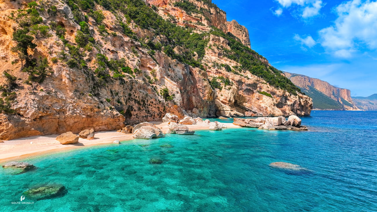
Between cliffs of pale limestone lies Cala Mariolu, one of the most surprising Sardinian beaches and a place that often confuses first-time visitors. From afar the shore looks white. Up close it is made almost entirely of tiny polished pebbles locals call “pùligi de nie” snow fleas. They move under your feet like dry grains of rice. Fishermen once named the cove after a thief: the monk seal blamed for stealing catches from their nets.
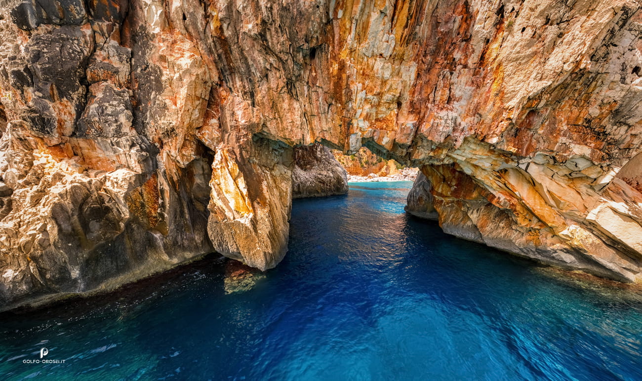
The animal disappeared decades ago, but the nickname stayed. Look carefully along the cliffs and you will notice caves carved by centuries of winter storms. Some can only be reached by swimming. Understanding how this small stretch of stones became one of the Mediterranean’s most photographed shorelines requires a deeper look beyond this teaser.
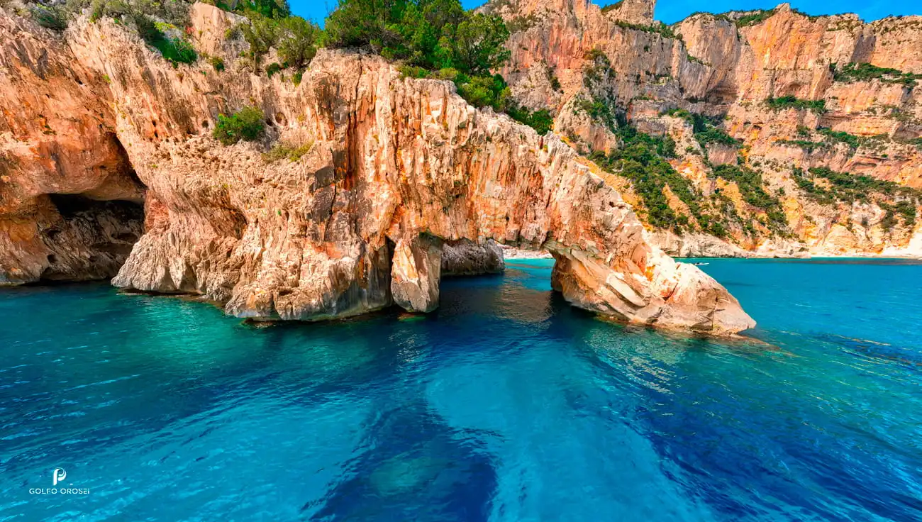
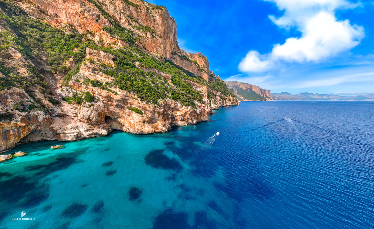
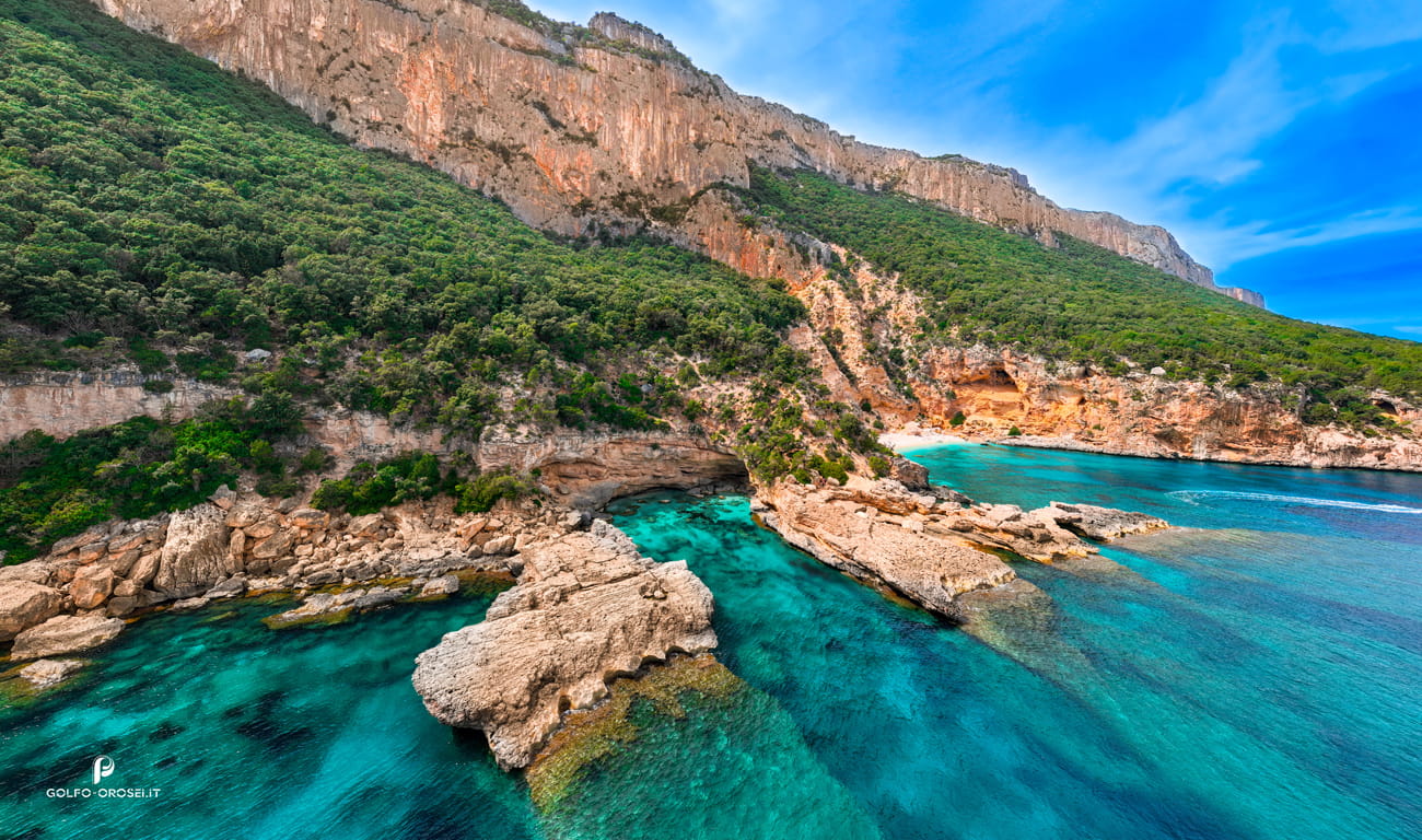
Hidden between steep walls of the Gulf, Cala Biriola rarely appears in the first photographs travelers see of Orosei. Yet sailors have long recognized it by the color of its water, which turns unexpectedly emerald near the shore because of the pale sand beneath. A small arch of rock stands at the northern edge, sculpted slowly by waves and wind. Local boat captains often slow down here, pointing to dark openings in the cliff where smugglers supposedly hid goods during the last century.
The beach is not large, but its position makes it feel like a natural balcony between sea and mountain, a perspective rarely found among Sardinian beaches. Understanding why photographers linger here longer than planned becomes clearer once you explore the story of this cove.
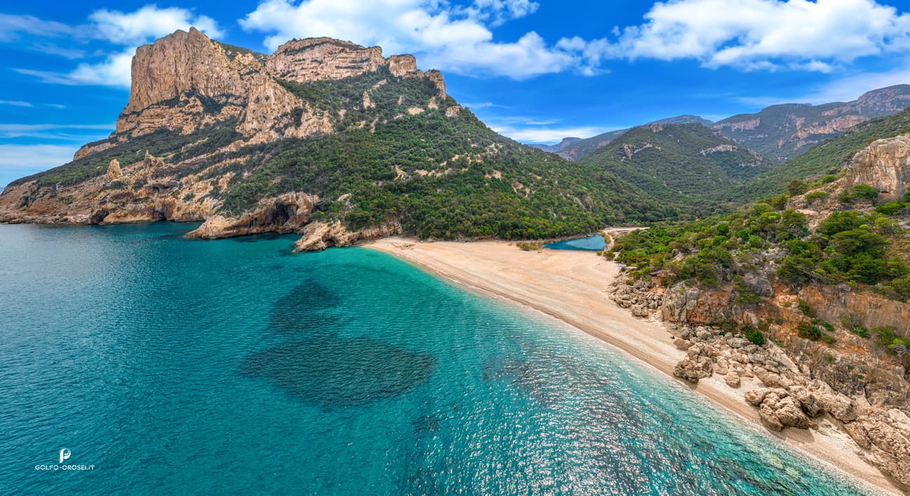
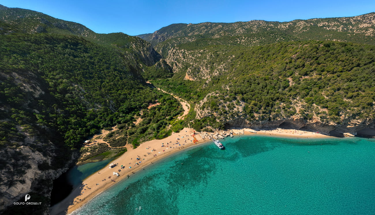
Where the Codula di Sisine canyon meets the sea, the landscape suddenly widens. After kilometers of wild valley, the riverbed of pale stones spills onto a broad beach framed by cliffs. Hikers often arrive dusty from the long trail, surprised by how large the shoreline feels compared with other coves of the gulf. Behind this Sardinian beach the canyon continues inland, a wild corridor that shepherds used for centuries to move flocks between mountains and coast.
Pieces of driftwood often gather here after winter floods, creating temporary sculptures along the shore. The place feels less like an isolated cove and more like the mouth of a landscape. The deeper history of this valley-to-sea connection reveals itself in the dedicated page waiting ahead for.
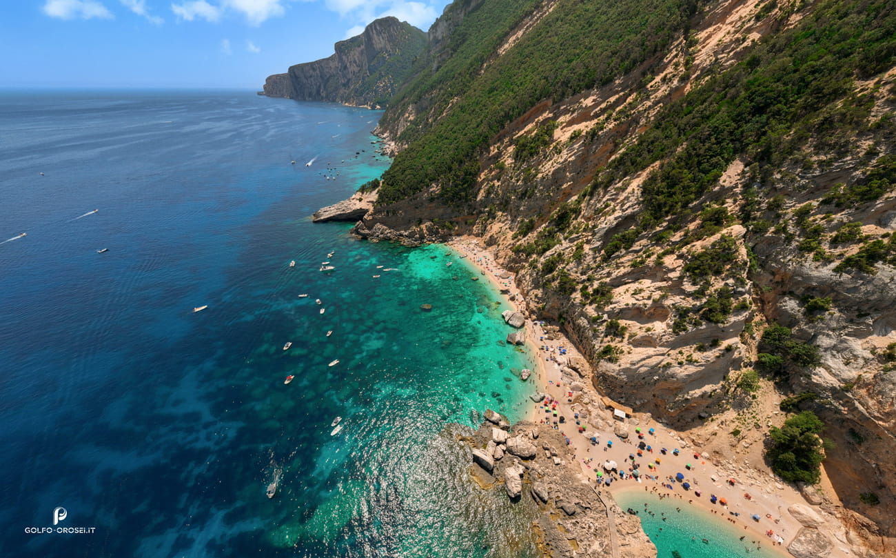
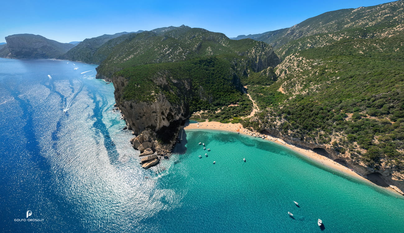
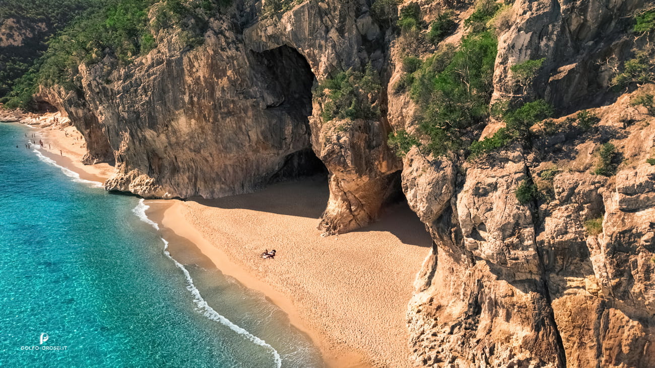
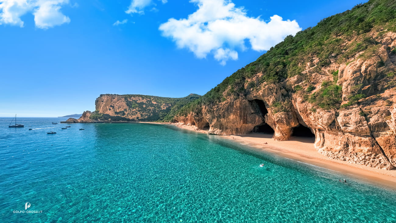
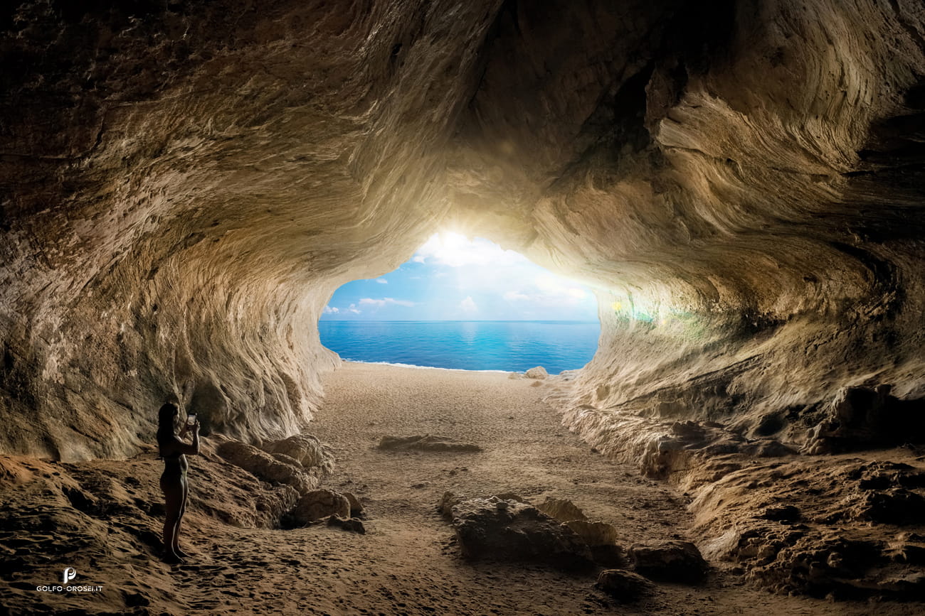
Few Sardinian beaches begin with a cave. Cala Luna does. Along the northern side of the shore, open directly onto the sand, carved by centuries of freshwater flowing from the mountains behind. In the morning the light enters these cavities like a stage spotlight, revealing layers of limestone and old swallow nests high on the rock. The beach itself stretches wider than most coves in the gulf, shaped partly by the seasonal river that reaches the sea here.
Kayakers often drift close to the cliffs searching for smaller caves hidden between shadows. The setting has appeared in films and expeditions, yet the geological story of how this amphitheater formed is even more compelling than expected explore further.
© 2026 ![]() Multiweb di Vitalii Iarosh VAT: 02320060227. All Rights Reserved.
Multiweb di Vitalii Iarosh VAT: 02320060227. All Rights Reserved.


 Italiano